


Voting District 10025, Placer County, California
About
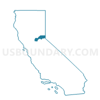
Outline

Summary
| Unique Area Identifier | 536647 |
| Name | Voting District 10025 |
| County | Placer County |
| State | California |
| Area (square miles) | 0.62 |
| Land Area (square miles) | 0.62 |
| Water Area (square miles) | 0.00 |
| % of Land Area | 100.00 |
| % of Water Area | 0.00 |
| Latitude of the Internal Point | 38.73012570 |
| Longtitude of the Internal Point | -121.30967910 |
Maps


Graphs
Select a template below for downloading or customizing gragh for Voting District 10025, Placer County, California


Neighbors
Neighoring Voting District (by Name) Neighboring Voting District on the Map
- Voting District 10000, Placer County, CA
- Voting District 10030, Placer County, CA
- Voting District 10045, Placer County, CA
- Voting District 10055, Placer County, CA
- Voting District 40994, Sacramento County, CA
- Voting District 41108, Sacramento County, CA
- Voting District 41111, Sacramento County, CA
Top 10 Neighboring County Subdivision (by Population) Neighboring County Subdivision on the Map
Top 10 Neighboring Place (by Population) Neighboring Place on the Map
Top 10 Neighboring Elementary School District (by Population) Neighboring Elementary School District on the Map
- Roseville City Elementary School District, CA (82,163)
- Dry Creek Joint Elementary School District, CA (52,939)
Top 10 Neighboring Secondary School District (by Population) Neighboring Secondary School District on the Map
Top 10 Neighboring Unified School District (by Population) Neighboring Unified School District on the Map
Top 10 Neighboring State Legislative District Lower Chamber (by Population) Neighboring State Legislative District Lower Chamber on the Map
Top 10 Neighboring State Legislative District Upper Chamber (by Population) Neighboring State Legislative District Upper Chamber on the Map
- State Senate District 1, CA (1,002,597)
- State Senate District 4, CA (988,287)
- State Senate District 6, CA (914,353)
Top 10 Neighboring 111th Congressional District (by Population) Neighboring 111th Congressional District on the Map
Top 10 Neighboring Census Tract (by Population) Neighboring Census Tract on the Map
- Census Tract 74.21, Sacramento County, CA (9,003)
- Census Tract 209.08, Placer County, CA (6,706)
- Census Tract 81.27, Sacramento County, CA (4,792)
- Census Tract 208.05, Placer County, CA (3,902)
- Census Tract 209.01, Placer County, CA (2,605)
- Census Tract 81.28, Sacramento County, CA (2,462)